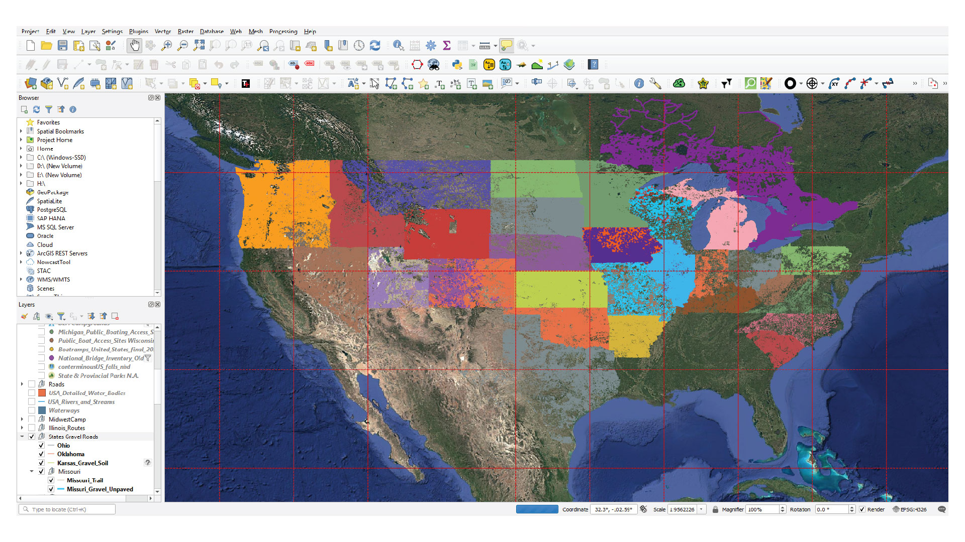
March, 2020. I guess we all still remember when things started to shut-down because of an "unknown" spread of something. It wasn't all bad, because I learned about geopspatial data and found a good use for it!
How it started
At the time of Covid, I was still living in the United States of America. In 2018 I started a Facebook group called Illinois Overlanders. Illinois isn't know for its amount of public land or off road areas. But there is a good amount of gravel roads throughout the state. However, many of the members relied on Onx or GAIA Gps to find these kind of roads. And if you look, you noticed that there wasn't much - according to these apps. Insert conversation I had with one of the members of the group.
Vague "shapefile" data with barely an explaination
The member of the group had found these shapefiles on the IDOT website. "Try to filter it between these and these values and it should give you some guidelines". Sure enough I got a rough outline of roads in the state of Illinois that showed if they were unpaved or not. But to me, this wasn't enough. I started to dig around more and found the manual that explained the information in this dataset. Unpaved - or B roads. The state of Illinois only has MVUMs in the most southern part near Garden of the Gods / Shawnee NF, a beautiful area that I would highly suggest to visit if you have the chance.
You mention MVUM, what is an MVUM? - a side quest
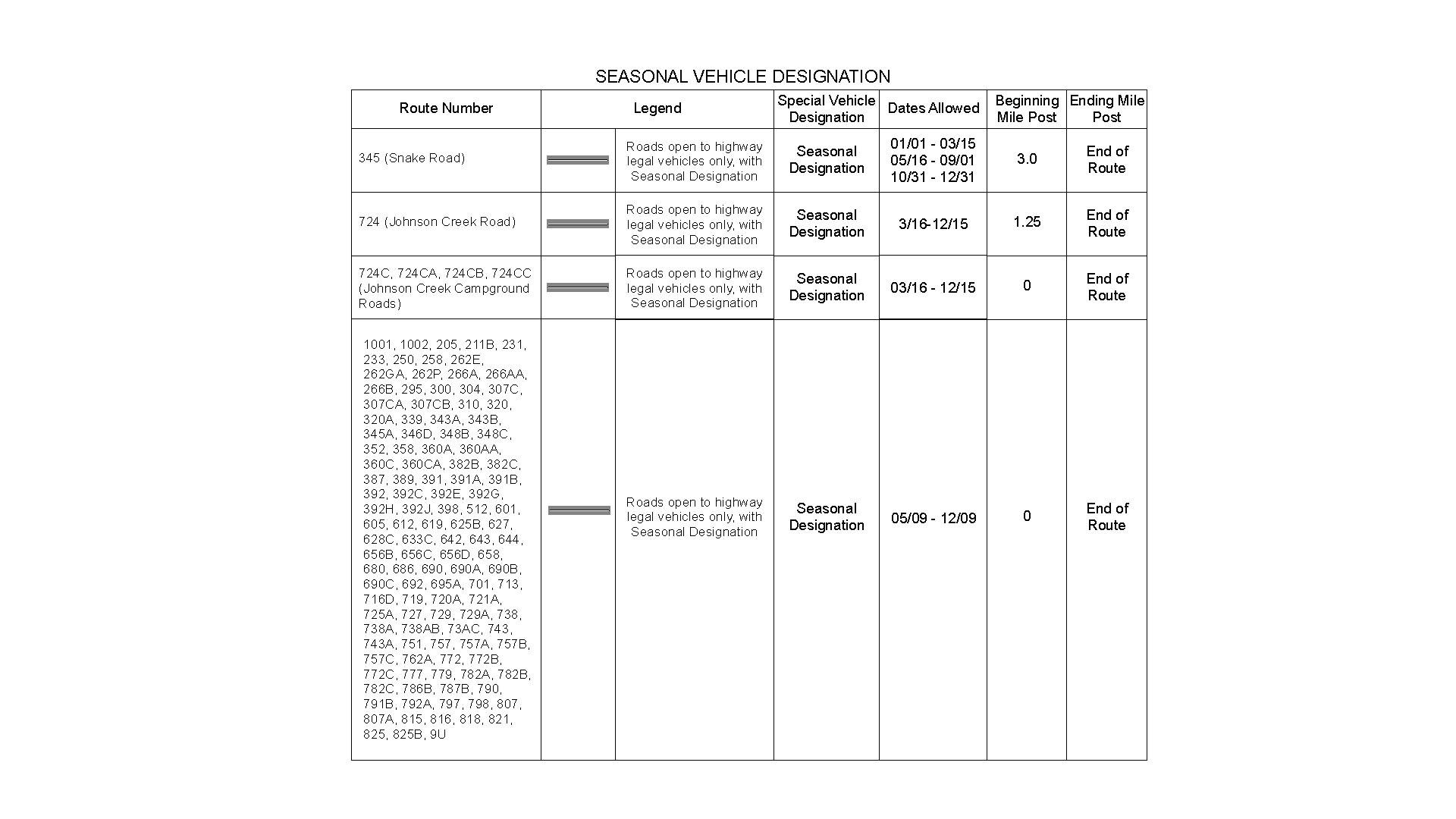
MVUM stands for Motor Vehucle Use Map. The image below is an example of these kind of maps. These can be obtained at some of the ranger stations of USFS (US Forest Service) or digitally obtained through apps like Avenza. 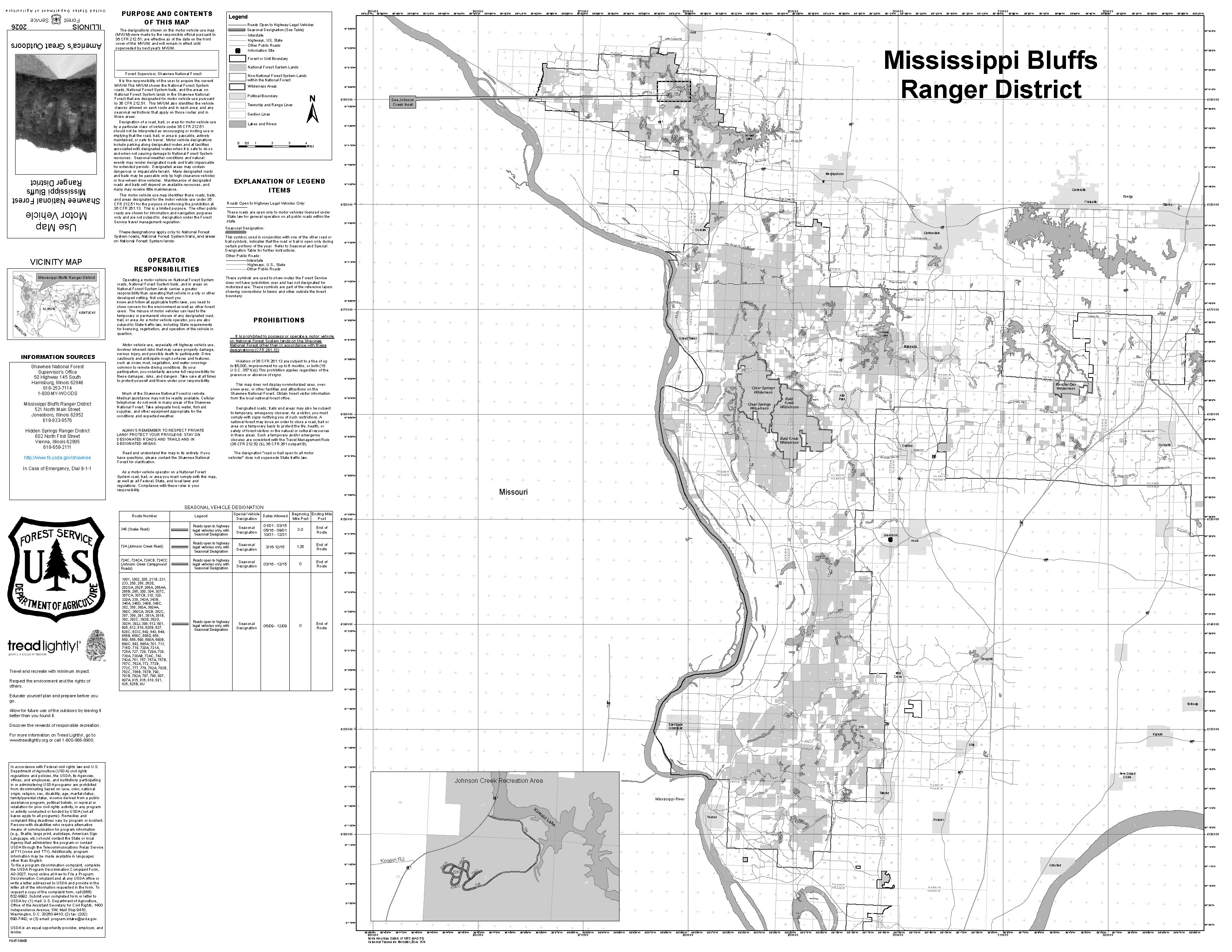 What is some of the information you may find on these kind of maps? We start with the legend which explains what all the "drawings" mean. What is a wilderness area. What is a highway etc. You will find useful phone numbers and addresses and often a list of roads which are designated at motorvehicle use within the boundaries of the area, see image below.
Challenge accepted! Can we do this for other states? Or even other countries?
As you might have seen in the intro image, yes it is possible for other states as well. However, trying to find the right data for each state is a challenge. Some states like Iowa and Wisconsin were fairly easy to obtain the correct information. But other states only maintain the road data based on OSM data. What that means is that the shapefile for certain roads really use generic information to determine if a road is a "local" road or a "major artery". As you can see, that doesn't mean a lot and makes finding the right information a challenge. Europe is even worse. Each country uses a different way on how to assign the road type to their roads making it truly a challenge trying to map the roads in QGIS like I have done for the United States.
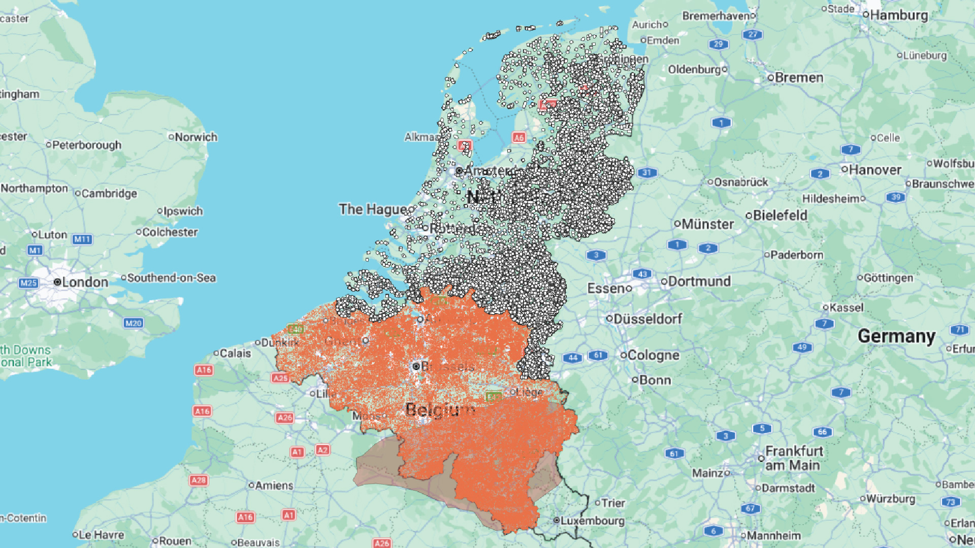
As you can see in the image above, I was able to do it for the Netherlands. Belgium is questionable because they marked also dead-end farm roads for their road information. Netherlands is pretty bad, mostly due to a lot of the dirt roads are dedicated for cyclists, pedestrians / equestrians. Just because it is difficult doesn't mean it is impossible. It just requires a little more work. I will update this blog post in the future if I ever get a big breakthrough.
As I am writing this, it is the nearing the end of 2026. I am still trying to get all the states in the US just for the heck of it.
Why am I doing this?
It started out as a baseline for my group on Facebook. Is Illinois really this bad? It was a question I had to get answered and it turned into 5 years of hunting down the right shapefiles of different states. But the knowledge tought me a few other things as well which became handy making my own adventure maps. I was able to import MBTiles into GAIA GPS. Export GEOPDF for Avenza. Create map layers for OSMAnd. All this pushed me to look for other things. Wood covered bridges throughout the USA. Wood traintrack bridges. And a lot of other cool stuff that many of these apps were not able to show me. The catch? I had to learn about an application called QGIS to make this all work. But it is almost like an addiction. And while I am here in the Netherlands, I decided to create a map with old WWII Bunkers to make my motorcycle adventures more exciting. I found a whole bunch of them and enjoyed every one of them. Included a few castles and little that I knew, there are castle remnants not too far from me.
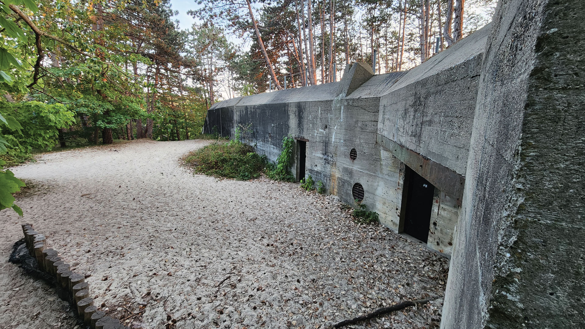
It is a lot of work but it showed me places I would have been driving by if I never got myself submerged into this stuff. I learned about a cool MTB route in North Dakota I never heard of before, and found fun gravel roads in the state I called home.
Final notes
Adventure isn't a prepacked package. It is a way of exploring and seeing things you would possibly just drive / walk by. Sometimes, detour a little from that fixed GPS file that was recommended by an Overland Guru. Who knows what cool stuff you may encounter. Stay adventurous. Keep exploring!